|
 |
|
|
|
|
| GEOTECH Bratislava, exclusive dealer and authorized service center of Leica Geosystems AG for Slovakia |
|
. |
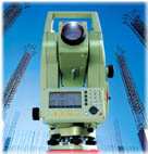
| GEODESY & GIS | BUILDING & CONSTRUCTION | GPS | ||
| Instruments and software for geodesy, aerial and terrestrial photogrammetry and GIS | Instruments for building and construction: for staking out of horizontal, vertical and slope surface; measuring of distance, measuring of slopes and other parameters of constructions | Special web page dealing with GPS instrument for surveying, navigation, tourism, agriculture and more | ||
 |
 |
 |
||
| Total stations, GPS, levels, laser distance meters for surveying and GIS, laser scanners (HDS), airborne sensors for photogrammetry, office equipment and surveying accessories | Levels, construction total stations, theodolites, laser distance meters, construction lasers, pipe lasers, interior lasers, construction machine automation, detectors, inclinometers, platelayer's gauges, wheel measures, tape measures | GPS Leica for Geodesy and GIS, GPS Garmin for navigation, GPS for precise agriculture, digital maps and software |
| * |
|
2005 |
March 2006 |
June 2006 |
July 2006 |
July 2006 |
December 2006 |
December 2006 |
|
SmartStation - world first total station with integrated GPS |
SmartRover - the world lightest cable-free RTK GPS system. Leica GNSS use satellites GPS and GLONASS ! |
Slovak network of permanent GPS reference stations (SK-POS) - public procurement - commentary
|
Unbelievable price for precise reflectorless total stations TCR803 R100 |
ScanStation - world first laser scanner with features of total station |
Leica SmartPole and Leica SmartWorx - infinitive combinations |
Especial offer of high-quality second-hand total stations |
© GEOTECH Bratislava, Last updated: 21.02.2007